PAGES ABOUT
Theosophy
general pages about
and The History of Theosophy
in
____________________
The 13 Historical
Welsh Counties
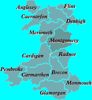
The
Thirteen Historical Welsh counties which
developed
during the Middle age and existed until 1974
Denbighshire, Montgomeryshire, Radnorshire,
Brecknockshire
and Monmouthshire were established
by
Act of Parliament of 1535 to the replace the
Marcher
Lordships which were a colonial
occupation
system. The other 7 counties had existed
since
the 13th century.
Modern Gazetteer of the
Historical Welsh Counties
Known in
Welsh as Sir Fôn. An island County separated from the mainland of
Caernarfonshire by the Menai Straits to which it is connected by the
The island is
about 20 miles long, 26 miles broad. Area 176,630 acres. Population 68,000. It
is the only county in
rivers are
the Braint and the Cefni.
The main
towns are Holyhead, Llangefni, Amlwch and
The most
important industries are agriculture and tourism.
Places of
special interest:
Bryn Celli
Ddu neolithic tomb
Din Lligwy iron
age village
Lynnon
Windmill, Llanddeusant
Plas Newydd
gardens
St Seriol's
Well
South Stacks
RSPB bird reserve
Brecknockshire
Also known as
Breconshire or, in Welsh, as Sir Frycheiniog. An inland County bounded N. by
Radnorshire, E. by Herefordshire and Monmouthshire, S. by Monmouthshire and
Glamorgan, and W. by Carmarthenshire and Cardiganshire.
Area 475,224
acres. Population 56,000. The County is predominantly rural and
mountainous.
The
Pen-y-Fan
(2907 ft). The River Wye traces nearly the whole of the N. boundary, and the Usk
flows in an easterly direction through the central valley. Of the many
waterfalls in the County,
The most important
industries are agriculture, forestry and tourism.
Places of
special interest:
Brecknock
Musuem, Brecon
Y Gaer Roman
Fort
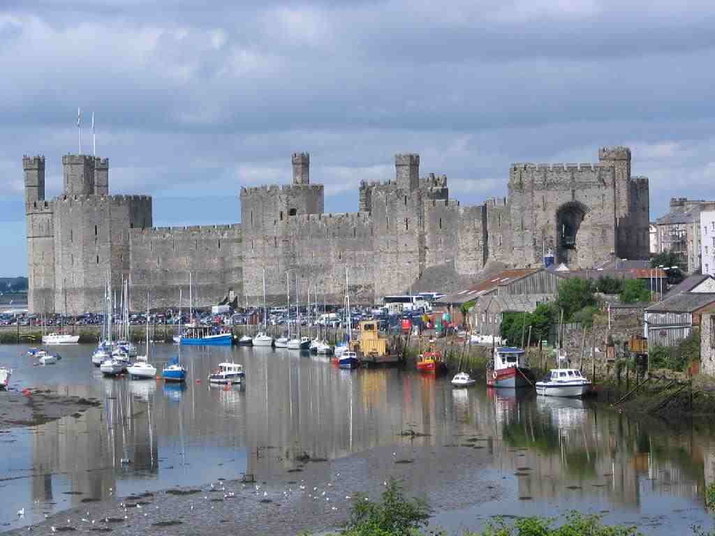
Caernarfonshire
Also known as
Carnarvonshire or, in Welsh, as Sir Gaernarfon. A maritime County bounded N. by
the Irish Sea, E. by Denbighshire, S. by Cardigan
Bay and
Merioneth, and W. by Caernarfon Bay and the Menai Straits, which separates it
from Anglesey.
Area 361,156
acres. Population 128,000. The surface is mountaineous. A large part of the
Snowdonia National Park lies in the County
including
Snowdon, the highest mountain in Wales (3560 ft). The Lleyn Peninsula is less
mountaineous and contains many bays and sandy beaches.
Bardsey Island is
a major site for nesting seabirds. The River Conwy runs north along the Easten
boundary.
Principal
towns are Bangor, Betws-y-Coed, Caernarfon, Conwy, Porthmadog and Pwllheli.
Sheep rearing and tourism are the main industries, the coast being much
developed for the latter.
Places of
special interest:
Bardsey
Island
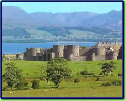
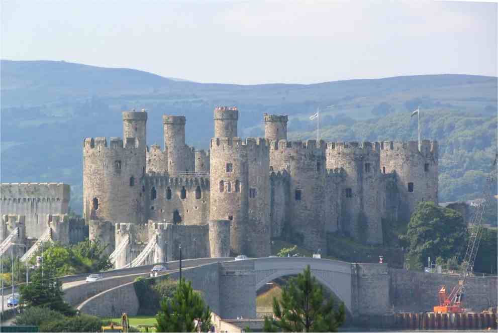
Caernarfon
Castle
Conwy Castle
Cricceith
Castle
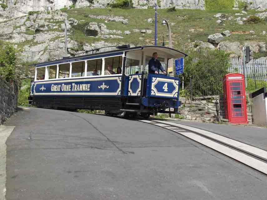
Great Orme
Tramway
Gwydir
Castle, nr. Llanrwst
Penrhyn
Castle
Swallow
Falls, Betws-y-Coed
Snowdon
Mountain Railway, Llanberis
Ty Mawr
Wybrnant
Cardiganshire
Known in
Welsh as Ceredigion or Sir Aberteifi. A maritime County bounded W. by Cardigan
Bay, N. by Merioneth, E. by Montgomeryshire, Radnorshire and Brecknockshire,
and S. by Carmarthenshire and Pembrokeshire. Area 440,630 acres. Population
64,000. The Cambrian Mountains cover much of the E. of the County. In the S.
and W. the surface is less elevated. The highest point is Plynlimmon at 2,486
feet at which five rivers have their source: the Severn, the
Wye, the
Dulas, the Llyfnant and Rheidol, the last of which meets the Mynach in a 300-foot
plunge at the Devil's Bridge chasm. The 50 miles of coastline has many sandy
beaches.
The main
towns are Aberaeron, Aberystwyth, Cardigan, Lampeter, New Quay, Newcastle Emlyn
(partly in Carmarthenshire) and Tregaron.
The chief
river is the Teifi which forms the border with Carmarthenshire and
Pembrokeshire for much of its length. Tourism and agriculture, chiefly hill
farming, are the most important industries.
Places of
special interest
Ceredigion
Museum, Aberystwyth
Devil's
Bridge
Strata Florda
Abbey
Vale of
Rheidol Railway
Carmarthenshire
Known in
Welsh as Sir Gaerfyrddin. A maritime County bounded N. by Cardiganshire, E. by
Brecknockshire and Glamorgan, S. by the Bristol Channel and W. by
Pembrokeshire. The largest County in Wales. Area 587,816 acres.
Population
167,000.
The surface
generally is upland and mountainous. Fforest Fawr and Black Mountain extend
into the E. of the County and the Cambrian Mountains into the North. The S.
coast contains many fishing villages and sandy beaches. The highest point is
Carmarthen Fau (2,525 feet). Principal towns are
Ammanford,
Burry Port, Carmarthen, Kidwelly, Llanelli, Llandeilo, and Llandovery. The main
rivers are the Tywi, the Lougher (which forms the E. boundary with Glamorgan),
and the Gwendraeth Fawr. The principal industries are
agriculture,
forestry, fishing and tourism.
Places of
special interest:
Carreg Cennen
Castle
Dolaucothi
Gold Mines
Kidwelly
Castle
Laugharne
Castle
National
Botanic Garden of Wales
Pembrey
Country Park
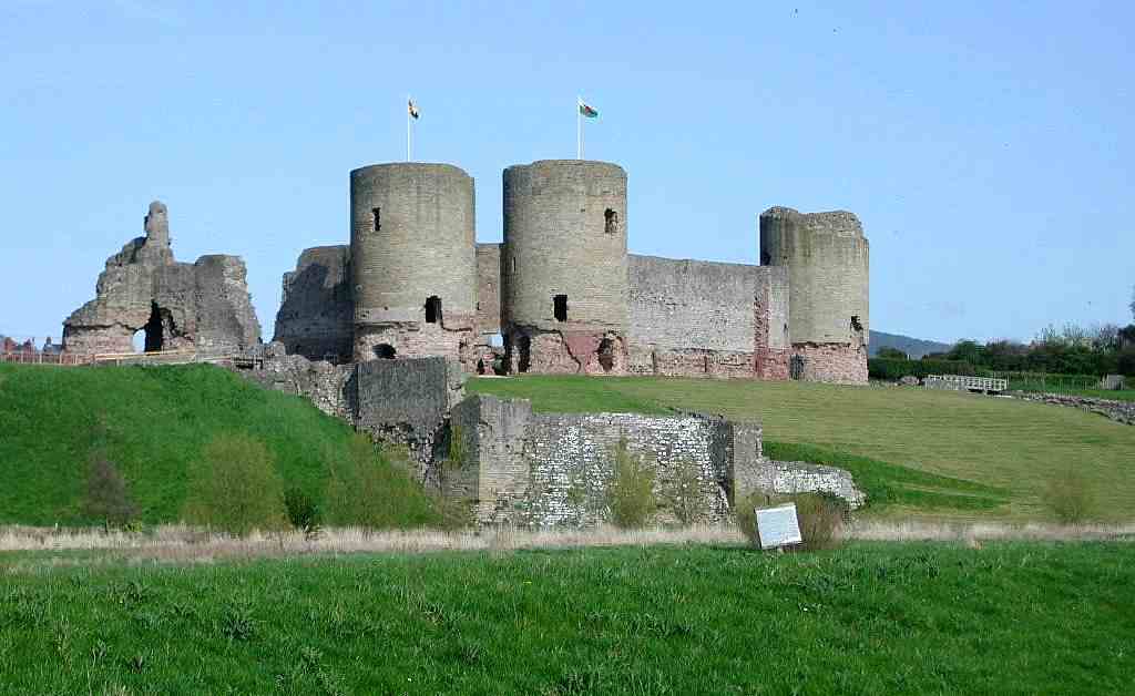
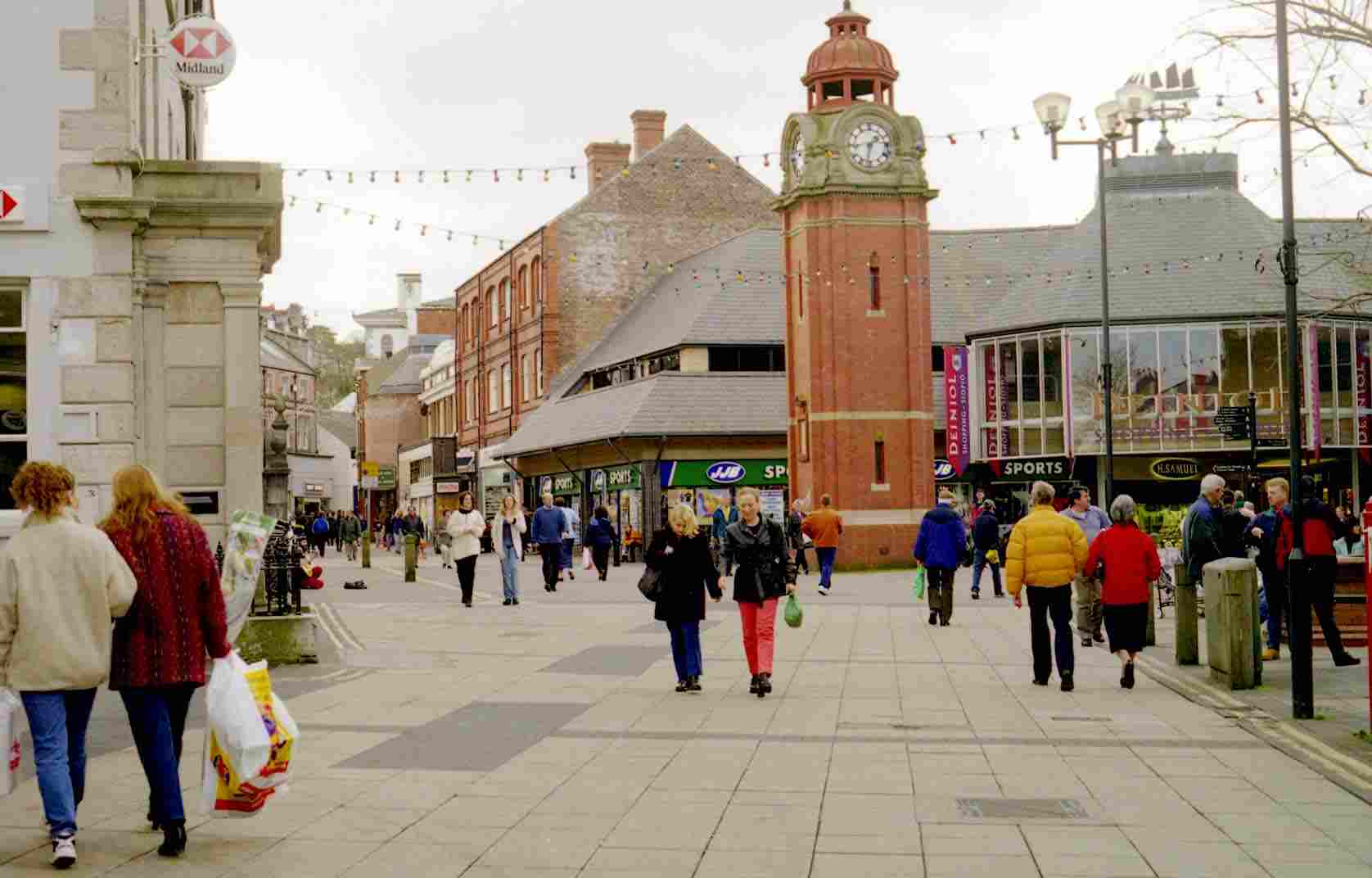
Denbighshire
Known in
Welsh as Sir Ddinbych. A maritime County bounded N. by the Irish Sea, E. by
Flintshire, Cheshire and Shropshire, S. by Montgomeryshire and Merioneth, and
W. by Caernarfonshire. Area 423,499 acres. Population
205,000. In the
S. and W. of the County the mountains of the Clwydian Range rise from 1000 to
2500ft high. The E. of the County if hilly. There is some level ground along
the coastal strip. The highest points are Moel Sych and Cader
Berwyn at
2,713 feet. Pistyll-y-Rhaeader is a spectacular 240 feet waterfall.
The chief
rivers are the Clwyd and the Dee. The River Conwy runs north along the W.
boundary. The main towns are Abergele, Denbigh, Colwyn Bay, Llangollen,
Llanrwst, Ruthin and Wrexham. The most important industries are agriculture and
tourism.
Places of
special interest:
Bodnant
Gardens, Tal-y-Cafn
Chirk Castle
Denbigh
Castle
Eliseg's
Pillar
Plas Newydd,
Llangollen
Valle Crucis
Abbey
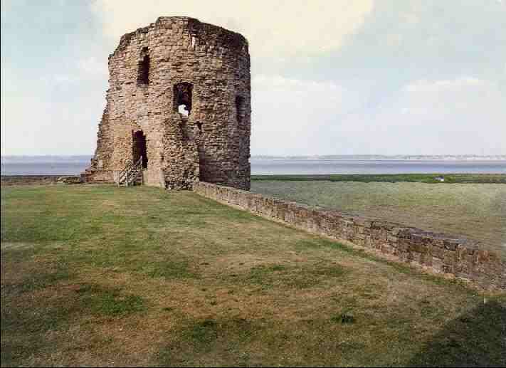
Flintshire
Known in
Welsh as Sir y Fflint. A maritime County bounded N. by the Irish Sea, NE by the
Dee estuary, E. by Cheshire and S. and SW. by Denbighshire. A large detached
part (Maelor Saesneg) is bounded on the NW by Denbighshire, on the NE by
Cheshire, and on the S. by Shropshire. There is a further small detached part
around Marford. Flintshire is the smallest County in Wales. Total area 164,744
acres. Population 203,000. The coast along the Dee estuary is
heavily
developed by industry and the N. coast much developed for tourism.
The Clwydian
Mountains occupy much of the W. of the County. The highest point is Moel Fammau
(1,820 feet). The chief towns are Bangor-is-y-coed, Buckley, Connah's Quay,
Flint, Holywell, Mold, Prestatyn, Queensferry, Rhyl, Shotton and
St. Asaph.
The main rivers are the Dee (the estuary of which forms much of the coast) and
the Clwyd. The main industries are steelworking, agriculture and tourism.
Places of
special interest:
Flint Castle
Hawarden
Castle
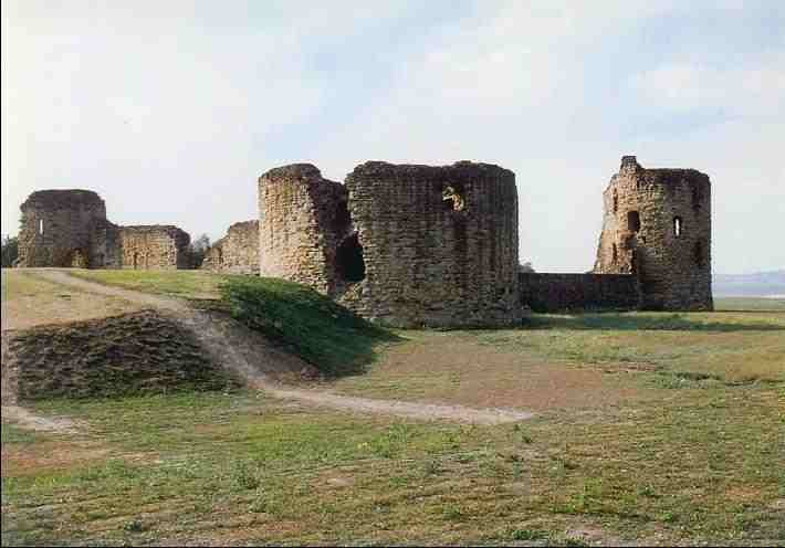
Rhuddlan
Castle
St. Asaph
Cathedral
Sun Centre,
Rhyl
Welsh Ewloe
Castle
Wepre Country
Park, Connah's Quay
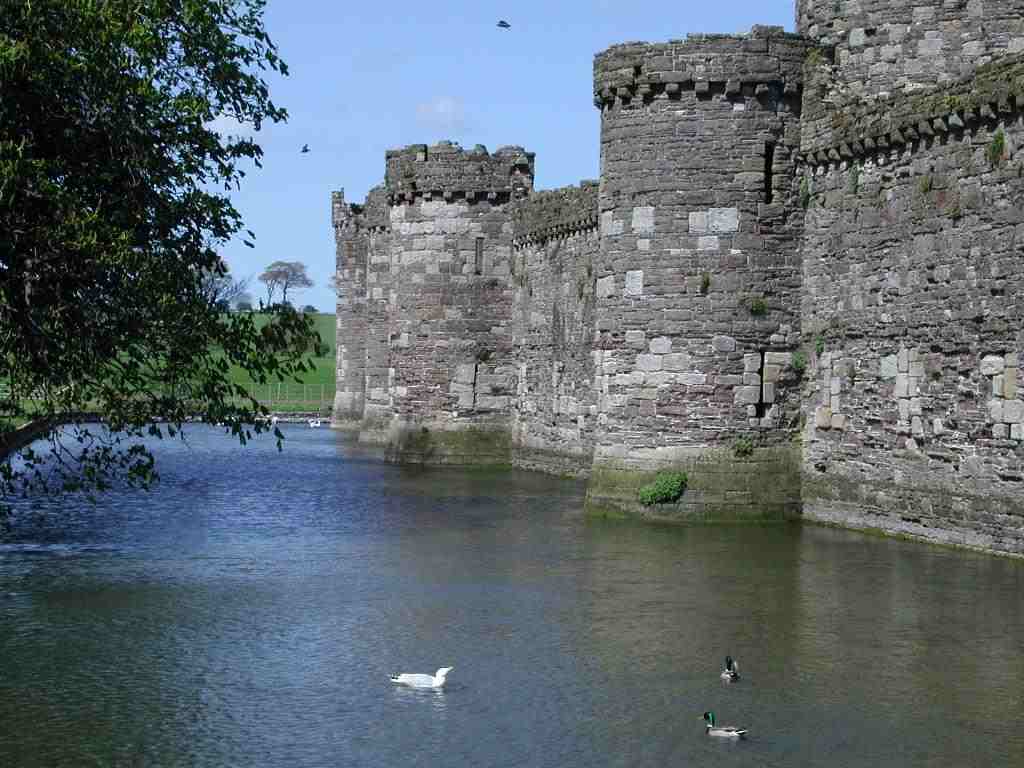
Glamorgan
Known in
Welsh as Morgannwg. A maritime County bounded N. by Brecknockshire, E. by
Monmouthshire, S. by the Bristol Channel, and W. by Carmarthenshire and
Carmarthen Bay. Area 518,863 acres. Population 1,220,000.
The highest
point is at Craig-y-llyn (1,969 ft). Glamorgan is the most populous and
industrialised County in Wales. The northern part of the County is a
mountainous area, dissected by deep narrow valleys, with urbanisation typified
by ribbon devlopment. Although the coal industry, which shaped these valleys
and their communities, has now all but disappeared, this area remains heavily
populated
with light industry and the service sector now providing the economic base.
The Vale of
Glamorgan, a lowland area mainly comprising farmland and small villages
stretches across most of the S. of the County from Porthcawl to Cardiff.
Further W., beyond Swansea, lies the Gower penisula, an Area of Outstanding
Natural Beauty. The major rivers of Glamorgan include the Taff, the Ely, the
Ogmore, the Dulais, the Rhymney (which forms the border with Monmouthshire) and
the Lougher (which forms the border with Carmarthenshire).
The main
towns include Aberdare, Barry, Bridgend, Cardiff, Caerphilly, Cowbridge,
Maesteg, Merthyr Tydfil, Mountain Ash, Neath, Penarth, Pontypridd, Porthcawl,
Port Talbot, Swansea. The County has a wide and diverse economic base
including: public administration, agriculture, light industry, manufacturing,
service
sector, tourism.
Places of
special interest:
Aberdulais
Falls
Barry Island
pleasure beach
Caerphilly
Castle
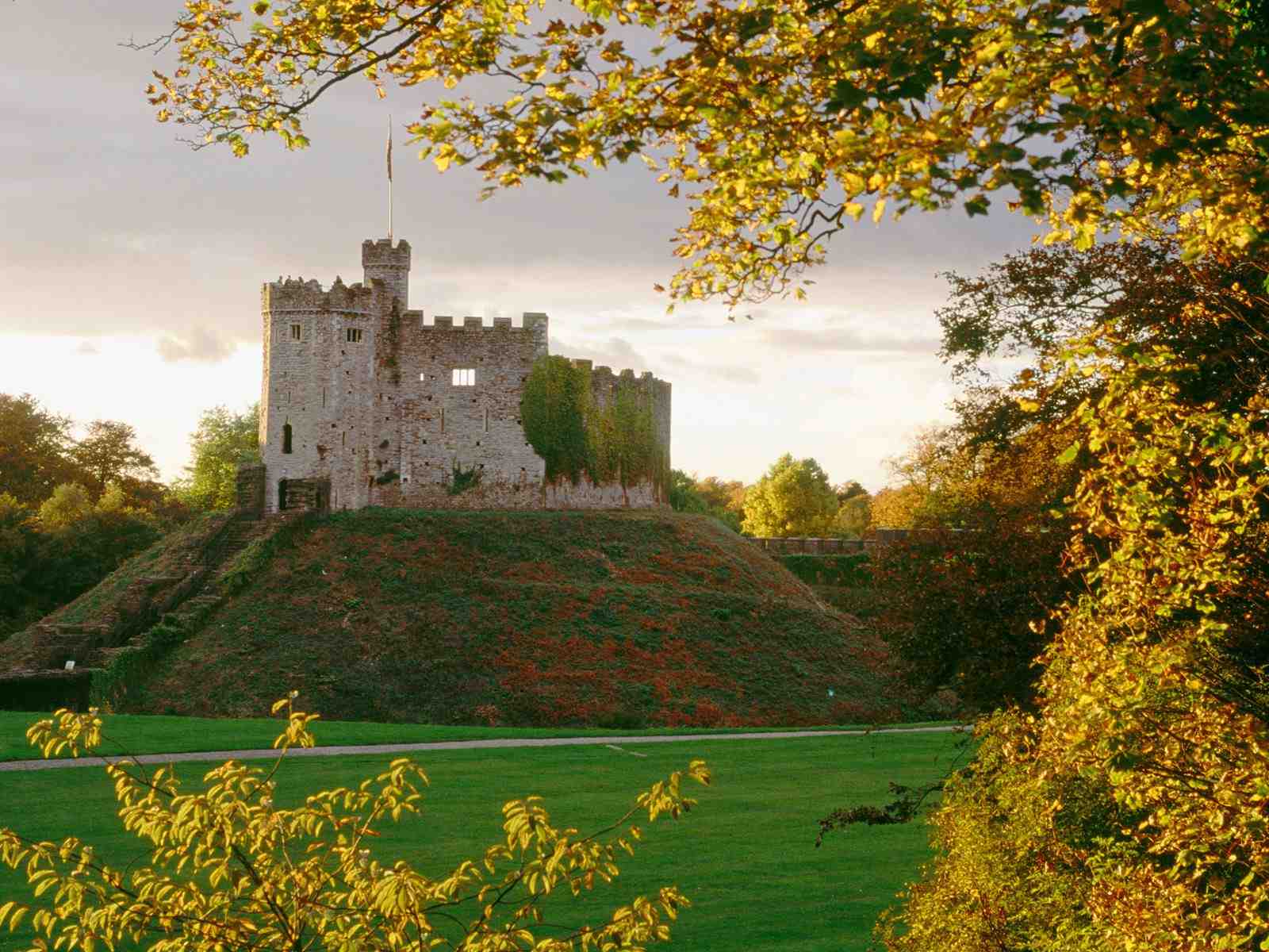
Cardiff
Castle
Castell Coch,
Tongwynlais
Ewenny Priory
Llandaff
Cathedral
Dare Valley
Country Park
Dunraven
Park, Southerndown
Museum of
Welsh Life, St. Fagans
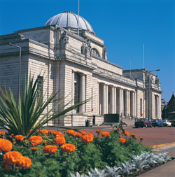
National
Museum of Wales, Cardiff
Old Beaupre
Castle
Ogmore Castle
Oxwich Castle
Margam
Country Park
Penscynor
Wildlife Park, Cilfrew
Swansea
Maritime and Industrial Museum Tinkinswood burial chamber
Weobley
Castle
Merioneth
Known in
Welsh as Meirionnydd. A maritime County bounded N. by Caernarfonshire, E. by
Denbighshire, SE. and S. by Montgomeryshire and
Cardiganshire,
and W. by Cardigan Bay. Area 427,810 acres. Population 39,000.
The coastline
is alternatively cliffs and streches of sand and the County generally is the
most mountainous in Wales. A large part of the Snowdonia National Park lies in
the County. The greatest heights are Aran Mawddwy (2970ft)
and Cader
Idris (2929 ft). The chief rivers are the Dwyryd, the Mawddach and the Dovey.
Waterfalls and small lakes are numerous the largest being Bala Lake (4 miles
long and 1 mile broad). The main towns are Bala, Barmouth, Blaenau
Ffestiniog,
Corwen, Dolgellau, Ffestiniog and Tywyn. The main industries are agriculture
and tourism.
Places of
special interest:
Castell-y-Bere
Cymer Abbey
Ffestiniog
railway
Harlech
Castle
Portmeirion
Mediterranean Style village
Rhug Chapel
Tomen-y-mur
Roman Fort
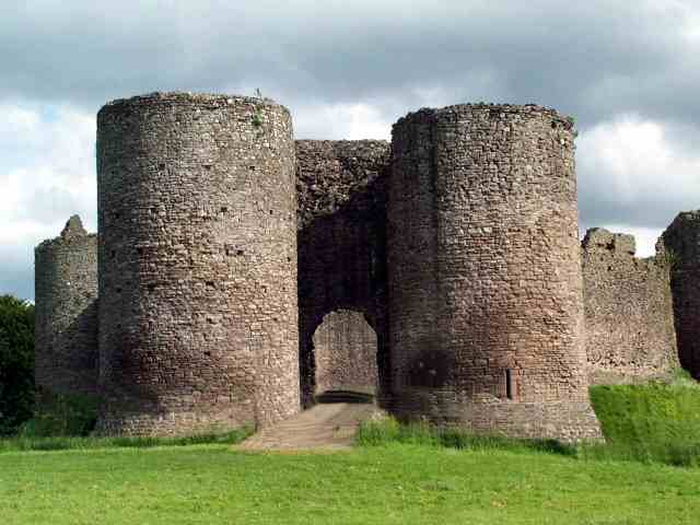
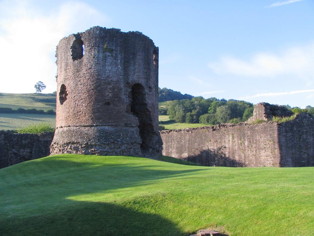
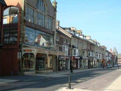
Monmouthshire
Known in Welsh
as Sir Fynwy. A maritime County bounded N. by Herefordshire and Brecknockshire,
E. by Gloucestershire, S. by the Bristol channel and W. by Glamorgan. Area
341,688 acres. Population 474,000. The N. and NW. of the County is mountainous,
the Black Mountains extend into the County.
The highest
point is Chwarel-y-Fan (2,226 ft). The former coal mining valleys of the NW of
the County remain heavily populated, although there is no longer a working pit
in the County. Towards the seaboard the land is flatter and lowland
farming
predominates. The main towns are Abergavenny, Abertillery, Blackwood,
Blaenavon, Chepstow, Cwmbran, Ebbw Vale, Monmouth, Newport, Pontypool, Rhymney
and Tredegar. The chief rivers are the Wye (much of which forms the border with
England), the Usk and the Rhymney (which forms the border with Glamorgan). The
County has a
diverse industrial base including agriculture, electronics, engineering,
tourism and service industries.
Places of
special interest:
Abergavenny
Castle
Big Pit Mining
Museum, Blaenavon
Blaenavon
Ironworks
Bryn Bach
Country Park, Tredegar
Chepstow
Castle
Caerleon
Roman Ampitheatre, Baths and Garrison. A possible site of King Arthur’s
Camelot.
Caerwent
Roman Town
Greenmeadow
Community Farm, Cwmbran Raglan Castle
Newport
Museum and Art Gallery
Sirhowy
Valley Country Park
Tintern Abbey
White Castle
Montgomeryshire
Known in
Welsh as Sir Drefaldwyn. An inland County, bounded N. by Denbighshire, E. and
SE. by Shropshire, S. by Radnorshire, SW by
Cardiganshire
and W. and NW. by Merioneth. Area 510,111 acres. Population 52,000. The County
is almost wholly mountainous, although there are some fertile valleys on the
Shropshire side. The highest point is Mole Sych (2,713 ft). The
principal
rivers are the Severn and its affluent, the Dovey. Lake Vyrnwy is a reservoir
supplying Liverpool. The main towns are Llanfyllin, Machynlleth, Montgomery,
Newtown and Welshpool. The main industries are agriculture (mainly hill
farming) and tourism.
Places of
special interest:
Bryn Tail
Lead Mine Buildings
Centre for
Alternative Technology, Machynlleth Dolforwyn Castle
Montgomery
Castle
Powis Castle,
Welshpool
Trefeglwys
Tumuli
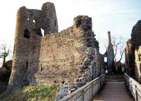
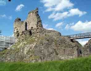
Pembrokeshire
Known in
Welsh as Sir Benfro. A maritime County, washed by the sea on all sides except
in the N. where it is bounded by Cardiganshire and in
the E. where
it is bounded by Carmarthenshire. Area 395,151 acres. Population 112,000. The
highest point is at Wadbury Hill (974 ft). The County looks out to sea on three
sides, taking in 170 miles of magnificent coastline comprising
important
seabird breeding sites and numerous bays and sandy beaches. Almost all
of the coast
is included in the Pembrokeshire Coast National Park. In the N. are the
Prescelly Mountains, a wide stretch of high moorland with many prehistoic
monuments. Elsewhere the County is relatively flat, most of the land being used
for lowland
farming. Oil tankers dock in the deep estuarine waters of Milford Haven.
The chief
rivers are the Eastern Cleddau, the Western Cleddau and the Solva. The main
towns are Fishguard, Haverfordwest, Milford Haven, Narberth, Newport, Pembroke,
Pembroke Dock, St. David's and Tenby. The main industries are
tourism,
agriculture and oil refining.
Places of
special interest:
Bishop's
Palace, Lamphey
Carew Castle
Carew Cross
Cilgerran
Castle
Manorbier
Castle
Oakwood
Leisure Park, nr Narberth
Pembroke
Castle, Birthplace of Henry Tudor later King HenryVII
Pentre Ifan
burial chamber
St.
David's Cathedral
Skomer Island
Skokholme
Island
Radnorshire
Known in
Welsh as Sir Faesyfed. An inland County, bounded N. by Montgomeryshire and
Shropshire, E. by Herefordshire, S. and SW. by
Brecknockshire
and W. by Cardiganshire. Areas 301,164 acres. Population 23,000.
In the E. and
S. are some comparatively level tracts, including the Vale of Radnor, but most
of the County is mountainous, with the Cambrian Mountains running through the
W. of the County. The highest point is at Radnor Forest (2,166 ft). The Elan
Valley contains several huge man-made reservoirs supplying water to Birmingham.
The main rivers are the Wye, the Elan and the Ithon. The chief towns are
Knighton, Llandrindod Wells, Llanelwedd, New Radnor, Presteigne and Rhayader.
The main industries are tourism and hill farming.
Places of
special interest:
Abbey Cwmhir
Beguildy
Tumuli
Broadheath
House, Presteigne
Elan Valley
Vistor's Centre
Offa's Dyke
The Rock
Park, Llandrindod Wells
PAGES ABOUT WALES
For more info on Theosophy
Try these
Cardiff Theosophical Society meetings
are informal
and there’s always a cup of tea afterwards
The
Cardiff Theosophical Society Website
The
National Wales Theosophy Website
Dave’s
Streetwise Theosophy Boards
Theosophy
Study Groups are invited to make
free use any of the material on this site
This is for
everybody not just people in Wales
Theosophy Cardiff’s Instant Guide to Theosophy
Cardiff
Theosophical Order of Service (TOS)
Within the British Isles, The
Adyar Theosophical Society has Groups in;
Bangor*Basingstoke*Billericay*Birmingham*Blackburn*Bolton*Bournemouth
Bradford*Bristol*Camberley*Cardiff*Chester*Conwy*Coventry*Dundee*Edinburgh
Folkstone*Glasgow*Grimsby*Inverness*Isle
of Man*Lancaster*Leeds*Leicester
Letchworth*London*Manchester*Merseyside*Middlesborough*Newcastle
upon Tyne
North
Devon*Northampton*Northern Ireland*Norwich*Nottingham
Perth*Republic of
Ireland*Sidmouth*Southport*Sussex*Swansea*Torbay
Tunbridge
Wells*Wallasey*Warrington*Wembley*Winchester*Worthing
One Liners & Quick Explanations
The Most Basic Theosophy Website in the Universe
If you run a
Theosophy Study Group you can use
this as an
introductory handout
No
Aardvarks were harmed in the
Includes stuff about Marlon Brando,
Old cars,
Odeon Cinema Burnley, Heavy Metal, Wales,
Cups of Tea, Mrs Trellis of North
Wales.
Her Teachers Morya &
Koot Hoomi
Theosophy and the Number Seven
A selection of
articles relating to the esoteric
significance of
the Number 7 in Theosophy
Lentil burgers, a
thousand press ups before breakfast and
the daily 25 mile
run may put it off for a while but death
seems to get most
of us in the end. We are pleased to
present for your consideration,
a definitive work on the
subject by a
Student of Katherine Tingley entitled
The
South of Heaven Guide to
Theosophy and Devachan
The main criteria
for the inclusion of
links on this
site is that they have some
relationship
(however tenuous) to Theosophy
and are
lightweight, amusing or entertaining.
Topics include
Quantum Theory and Socks,
Dick Dastardly and Legendary Blues Singers.
The Spiritual Home of Urban Theosophy
The Earth Base for Evolutionary Theosophy
Classic Introductory
Theosophy Text
A Text Book of Theosophy By C
What Theosophy Is From the Absolute to Man
The Formation of a Solar System The Evolution of Life
The Constitution of Man After Death Reincarnation
The Purpose of Life The Planetary Chains
The Result of Theosophical Study
An Outstanding
Introduction to Theosophy
By a student of
Katherine Tingley
Elementary Theosophy Who is the Man? Body and Soul
Body, Soul and Spirit Reincarnation Karma
Preface
Theosophy and the Masters General Principles
The Earth Chain Body and Astral Body Kama – Desire
Manas Of Reincarnation Reincarnation Continued
Karma Kama Loka
Devachan
Cycles
Arguments Supporting Reincarnation
Differentiation Of Species Missing Links
Psychic Laws, Forces, and Phenomena
Psychic Phenomena and Spiritualism
Quick Explanations with Links to More Detailed Info
What is Theosophy ? Theosophy Defined (More Detail)
Three Fundamental Propositions Key Concepts of Theosophy
Cosmogenesis Anthropogenesis Root Races
Ascended Masters After Death States
The Seven Principles of Man Karma
Reincarnation Helena Petrovna Blavatsky
Colonel Henry Steel Olcott William Quan Judge
The Start of the Theosophical
Society
History of the Theosophical
Society
Theosophical Society Presidents
History of the Theosophical
Society in Wales
The Three Objectives of the
Theosophical Society
Explanation of the Theosophical
Society Emblem
The Theosophical Order of
Service (TOS)
Glossaries of Theosophical Terms
by
Annie Besant
THE BUDDHIC AND
NIRVANIC PLANES
______________________
Annie Besant Visits Cardiff 1924
An Outline of Theosophy
Charles Webster Leadbeater
Theosophy - What it is How is it Known? The Method of Observation
General Principles The Three Great Truths The Deity
Advantage Gained from this Knowledge The Divine Scheme
The Constitution of Man The True Man
Reincarnation
The Wider Outlook Death Man’s Past and Future
Cause and Effect What Theosophy does for us
Karma Fundamental Principles Laws: Natural and Man-Made The Law of Laws
The Eternal Now
Succession
Causation The Laws of Nature A Lesson of The Law
Karma Does Not Crush Apply This Law
Man in The Three Worlds Understand The Truth
Man and His Surroundings The Three Fates
The Pair of Triplets Thought, The Builder
Practical Meditation Will and Desire
The Mastery of Desire Two Other Points
The Third Thread Perfect Justice
Our Environment
Our Kith and Kin Our Nation
The Light for a Good Man Knowledge of Law The Opposing Schools
The More Modern View Self-Examination Out of the Past
Old Friendships
We Grow By Giving Collective Karma Family Karma
National Karma
India’s Karma
National Disasters
Try these if you are looking
for a
local Theosophy Group or Centre
UK Listing of Theosophical Groups
Worldwide Directory of Theosophical Links
Worldwide links to
Free Theosophy Study Resources
Online

An
Independent Theosophical Republic
Long Live The Blavatsky Revolution!
Links to Free Online Theosophy Study
Resources
Courses, Writings, Commentaries,
Forums, Blogs
Finding Stuff in
National & Regional Wales Web
Directories
National
The Valley
Connection
Web Directory For Wales
Open Directory (Wales UK)
Regional: Europe:
United Kingdom: Wales
Wales Pages
Search Engine and Web Directory for Wales, UK
Welsh
Regions
North Wales
Regional Directory
Denbighshire,
North Wales, UK. LL21 – 0DD
West Wales Web
________________________
Cardiff
Theosophical Society in Wales
Cardiff, Wales, UK. CF24 – 1DL
_________________
Wales Picture Gallery
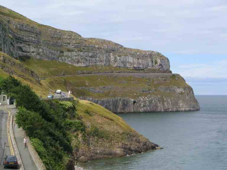
The
Great Orme
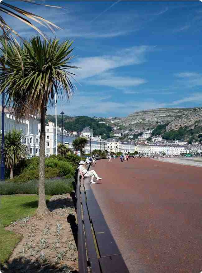
llandudno
Promenade
Great
Orme Tramway
New
Radnor
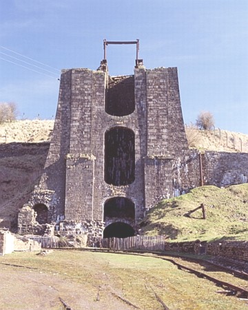
Blaenavon
Ironworks
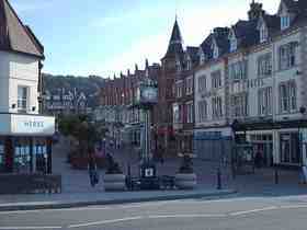
Llandrindod
Wells
Cardiff
Theosophical Society in Wales
Cardiff, Wales, UK. CF24 – 1DL
Presteign
Railway
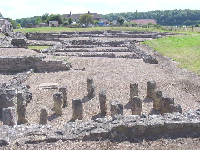
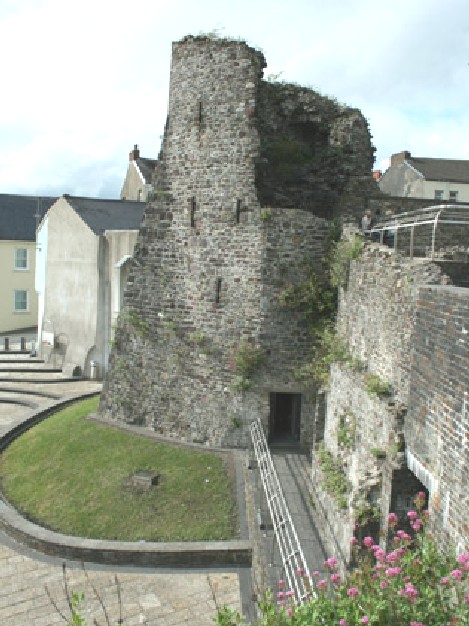
Caerwent Roman Ruins
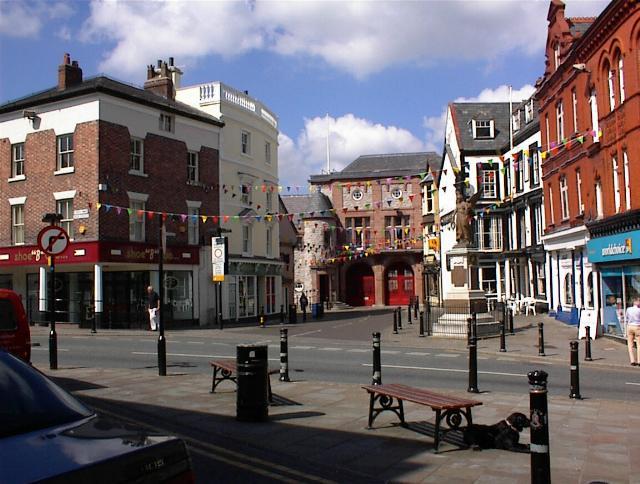
Denbigh
Nefyn
Penisarwaen
Cardiff
Theosophical Society in Wales
Cardiff, Wales, UK. CF24 – 1DL